Seeing Through Stone: How Next-Generation Geophysical Tools Are Rewriting the Rules of Mineral Exploration
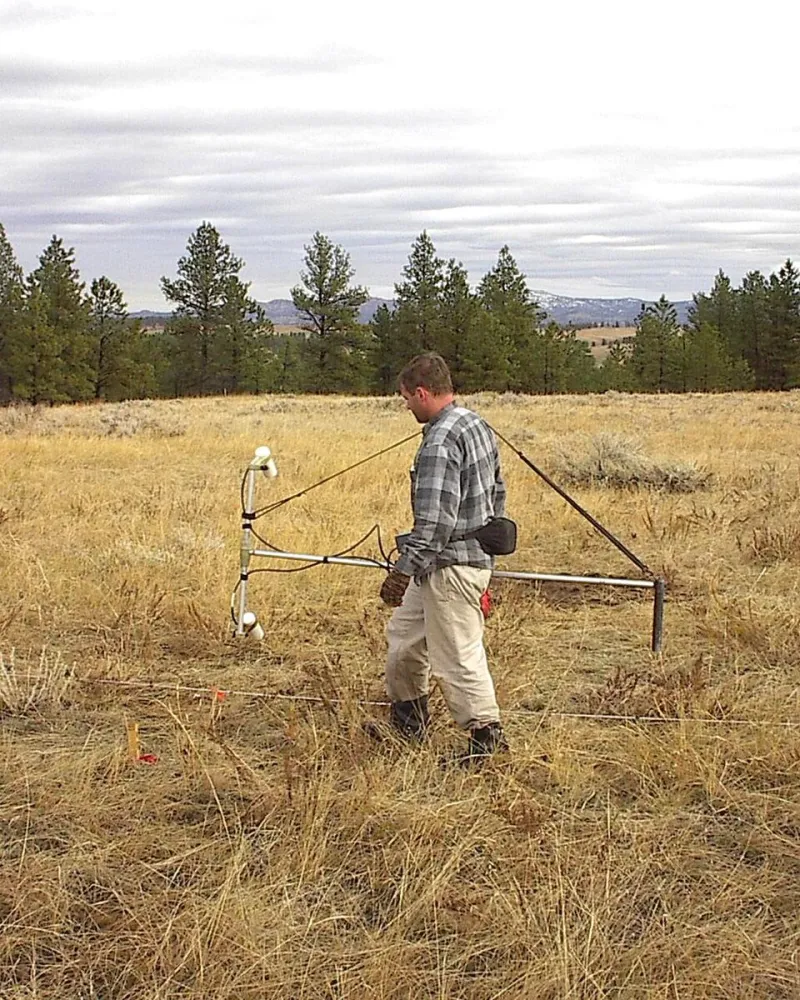
Photo: Tapatio, CC BY-SA 3.0, via Wikimedia Commons
For most of the twentieth century, mineral exploration operated on a principle that was equal parts science and intuition. Geologists read surface outcroppings, interpreted legacy drill core data, and drew on decades of accumulated field experience to place their bets on where valuable deposits might lie. The process was expensive, slow, and characterized by a failure rate that would be unacceptable in nearly any other capital-intensive industry. Today, that model is being systematically dismantled.
A convergence of advanced sensing technologies, machine learning algorithms, and unprecedented computational power is giving exploration teams an entirely new set of eyes—ones capable of resolving subsurface geology at a level of detail that was, until recently, the exclusive domain of academic research. The implications for US mineral production, particularly at a moment when domestic supply chains are under intense scrutiny, are difficult to overstate.
The Limitations of the Old Playbook
Traditional exploration workflows depended heavily on surface geology mapping, geochemical soil sampling, and conventional airborne magnetic and gravity surveys. These methods produced valuable data, but they painted the subsurface in broad strokes. A gravity anomaly might suggest the presence of a dense mineral body thousands of feet below grade, but it could not distinguish between a commercially viable copper porphyry and a geologically interesting but economically marginal intrusion.
The consequence was predictable: operators drilled expensive holes based on ambiguous signals, and the majority of those holes returned disappointing results. Industry estimates have long placed the discovery success rate for greenfield mineral exploration in the low single digits. That calculus is beginning to shift.
3D Seismic Imaging Comes to Hard-Rock Country
Seismic imaging has been a cornerstone of oil and gas exploration for decades, but its application to hard-rock mineral exploration has historically been limited by the complex, discontinuous nature of crystalline basement geology. Recent advances in acquisition technology and processing algorithms have begun to close that gap.
Operators deploying high-density 3D seismic surveys in regions such as the Midcontinent and the Basin and Range Province have reported the ability to image fault systems, lithological contacts, and alteration zones at depths exceeding one kilometer with a resolution that allows meaningful geological interpretation. In several documented cases, these surveys identified structural traps for mineralization that had been invisible to prior geophysical campaigns conducted over the same ground.
The cost of 3D seismic acquisition remains significant, but exploration teams are finding that the data density it provides can substantially reduce the number of drill holes required to define a resource, compressing both project timelines and capital expenditure.
Artificial Intelligence as a Predictive Engine
Perhaps the most consequential development in modern exploration is the application of machine learning to the challenge of mineral prediction. AI-powered models trained on integrated geophysical, geochemical, and geological datasets are demonstrating a capacity to identify exploration targets with a consistency that manual interpretation cannot reliably match.
Several junior and mid-tier mining companies operating in the western United States have publicly reported deploying predictive modeling platforms that ingest airborne electromagnetic data, multispectral satellite imagery, historical drill results, and regional structural geology into unified analytical frameworks. The outputs are probability maps—spatial representations of where the model assesses conditions to be most favorable for specific deposit types.
One Nevada-based operator described using such a system to rank exploration targets across a large land package. The model identified a cluster of anomalies in an area that had received only limited historical attention. Subsequent drilling intersected significant gold mineralization at depth, in a structural setting that the AI model had flagged as analogous to known producing systems in the district. The discovery would have been difficult to prioritize through conventional target generation.
Airborne Electromagnetics and the Deep Sulfide Problem
For operators pursuing base metal targets, airborne time-domain electromagnetic surveys have become an increasingly powerful tool for detecting conductive sulfide bodies at depth. Modern TDEM systems, flown at low altitude with high-moment transmitters, are capable of resolving conductors well below the depth range accessible to older frequency-domain platforms.
In the copper belts of Arizona and the polymetallic districts of the Rocky Mountain states, operators have used these systems to identify drill targets beneath thick overburden cover—terrain where surface expression is minimal and where historical exploration, constrained by the reach of available technology, left significant ground inadequately tested. The ability to see through cover is not a minor refinement; in many mature mining districts, it represents the difference between a brownfield asset with genuine exploration upside and a property considered largely exhausted.
Data Integration and the Digital Exploration Platform
The full value of these individual technologies is realized only when their outputs are synthesized within integrated digital platforms. Cloud-based geological information systems now allow exploration teams to layer seismic horizons, electromagnetic anomalies, geochemical halos, and predictive model outputs into unified three-dimensional environments that can be interrogated in real time.
This integration capability has practical consequences for decision-making velocity. Exploration managers can evaluate the spatial relationships between multiple datasets simultaneously, identify convergent anomalies where several independent lines of evidence point to the same location, and allocate drill budgets with a degree of analytical rigor that was not achievable when data resided in separate systems managed by separate technical disciplines.
The Competitive Calculus for US Operators
The adoption of advanced geophysical tools is not uniformly distributed across the industry. Large, well-capitalized operators have generally moved earliest, leveraging the scale economies that make significant technology investment justifiable. But the declining cost of airborne survey acquisition, the emergence of software-as-a-service AI platforms accessible to smaller organizations, and the availability of government-funded regional geophysical datasets through programs administered by the US Geological Survey are progressively democratizing access.
For operators who move decisively, the opportunity is real. Large portions of the American West, the Great Lakes region, and the southeastern Piedmont remain geologically underexplored by modern standards. The surface has been walked many times, but the subsurface—particularly below the depth range accessible to historical techniques—has not been systematically interrogated with contemporary tools.
The companies that build the technical capability to see through stone, and the analytical discipline to act on what they find, are positioning themselves at the front of a discovery cycle that has the potential to reshape the domestic mineral resource map. The horizon, it turns out, extends a great deal further downward than most operators have historically been willing to look.


